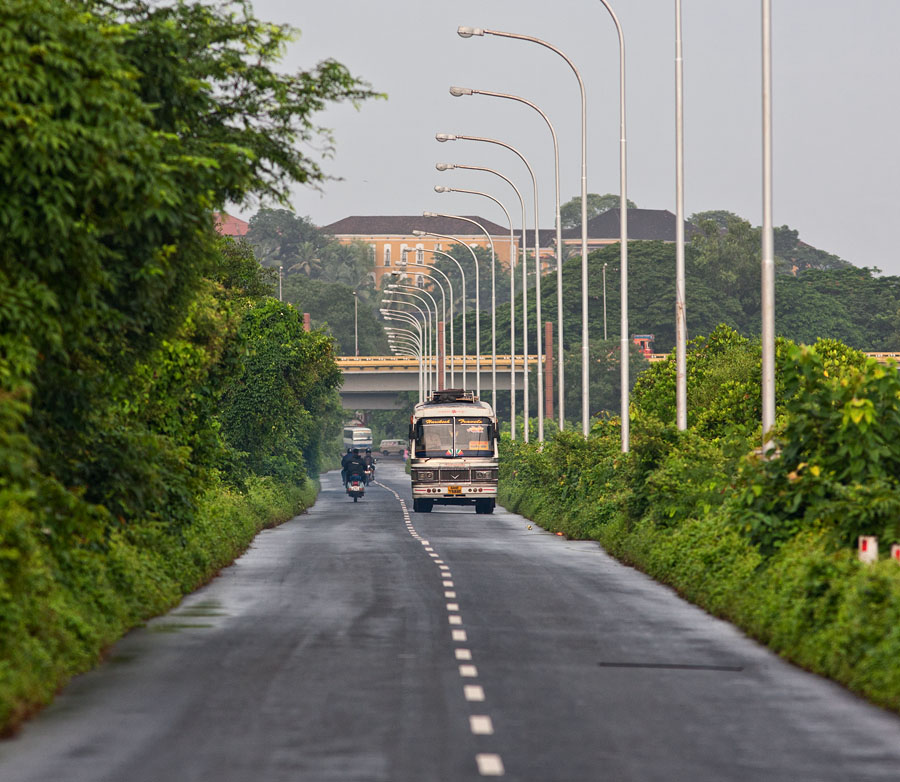
Ponte de Liñhares, the causeway joining Panjim and Ribandar, was built in 1633, and is acknowledged as a signal feat of engineering. Measuring just under 3 kms in length, the route is flanked by River Mandovi on one side and salt pans embedded in Khazan lands – a remarkable indigenous hydrologic system predating the Portuguese, designed to control tidal flow – on the other.
The construction of Ponte de Pangim, which was subsequently renamed Ponte de Liñhares, was ordered around 1633 by D. Miguel de Noronha, 4° conde de Linhares and 23rd Viceroy (1629-1635). It provided a link between Pangim and what later on came to be called the Second Ward of Nova Goa i.e. Ribandar…The bridge has a length of 4448 covados (one covado = 0.66 metre) so that its length is around 2935.68 metres. It has 38 arches on the Pangim side, the sixth being the widest. In its middle section, the bridge has another 3 arches; and at the Ribandar’s end, it has 3 more, with the middle one being the widest…Much of this road-cum-bridge was built within a year’s time.
The main motive which led D. Miguel de Noronha, who was a Portuguese nobleman, to order the undertaking of this major project was his determination to spend locally the revenues of the Estado da Índia rather than have to remit them to Portugal…An estimate of its cost computed at prices prevailing in the mid-1860s put the figure at around Rs. 40,000/- (A. Lopes Mendes). A project of this nature and magnitude would have cost over a hundred crores today, according to experts…
For centuries Ponte de Liñhares has held Goans in thrall with its visually soothing panoramas. But in the past 10 years, the explosion in motor traffic and the haphazard birth of hideous concrete structures on the overlooking hills have destroyed the beauty of the area and turned it into an eyesore.
These images were taken over a period of 3 years in varied weather and lighting conditions; the archival photographs adduced provide a ready historical perspective.
Go here for earlier installments of Panjim Promenade.
River Mandovi is seen on the left from the Panjim end of the causeway.
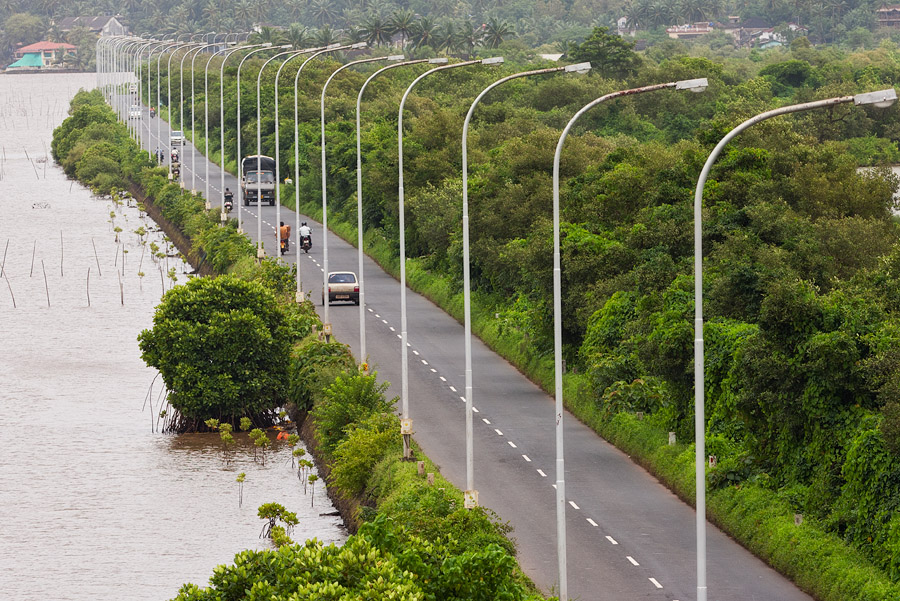
Ponte de Liñhares seen from Panjim
5D, 300L f/4 IS
This image was taken soon after sunrise from the hill in Ribandar. To the left of the causeway is the Khazan land with its salt pans – tiny mounds of crystallized salt are seen on the lower left.
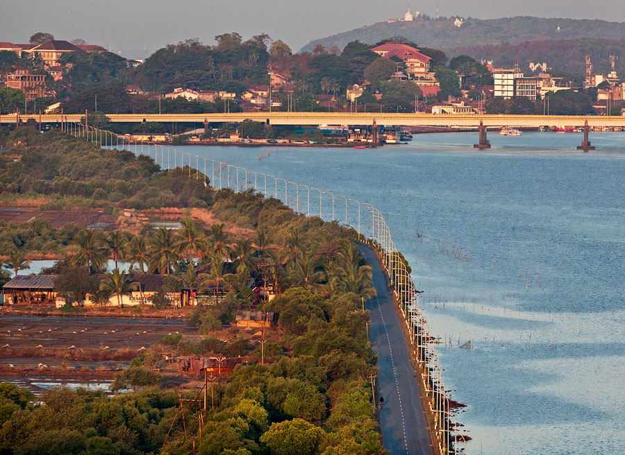
Ponte de Liñhares looking from Ribandar towards Panjim
5D, 300L f/4 IS
The sorry legacy of our deplorable builders and politicos in plain sight, looking over the Mandovi bridge (another Third World dud) from Panjim towards Ribandar. Notice the old white chapel of Our Lady of Remedios at the foot of the hill at the other end of Ponte de Liñhares. You will see it again in the archival photographs.
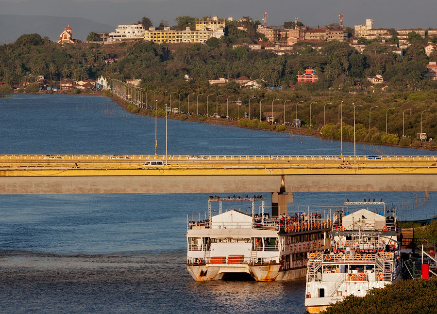
View of Mandovi bridge and Ponte de Liñhares from Panjim
5D, 300L f/4 IS
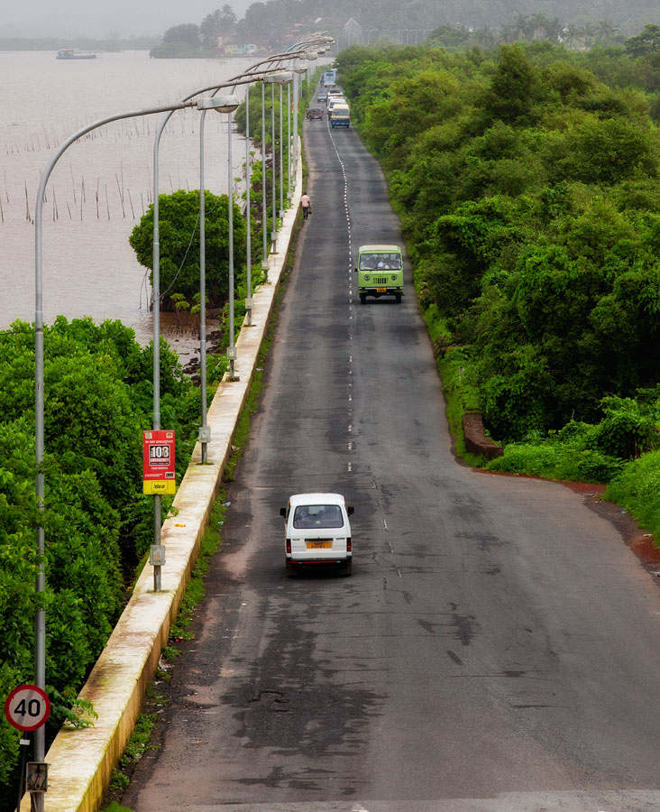
Ponte de Liñhares from Panjim on a monsoon morning
5D Mark II, 70-200L f/2.8 IS II
Ponte de Liñhares
5D, 300L f/4L IS
In this c. 1900 view from the hill near the current High Court in Panjim, both the Mandovi river and the Khazan salt pans are seen in their pristine condition. Look carefully for the Remedios chapel at the far end. This and the next image are photographs of photographs from the Souza & Paul collection now in the custody of Central Library in Panjim.
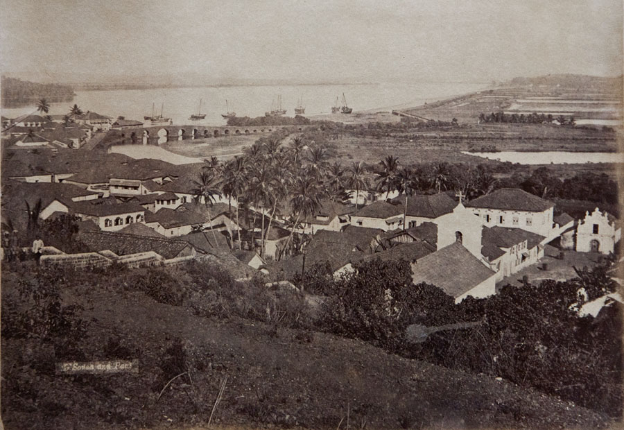
Ponte de Liñhares c.1900 (Central Library Archives)
5D, 24-105L
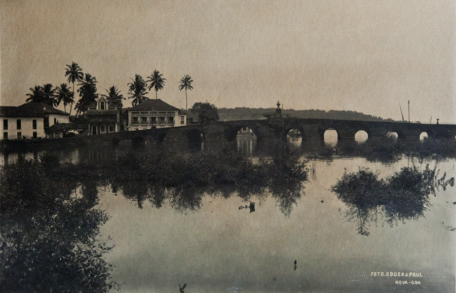
Ponte de Linhares c.1900 - entrance into Panjim (Central Library Archives)
5D, 24-105L
The final two images are photographs of photographs from the book Postais Antigos do Estado da Índia by João Loureiro (sponsored by Fundação Macau, 1998).
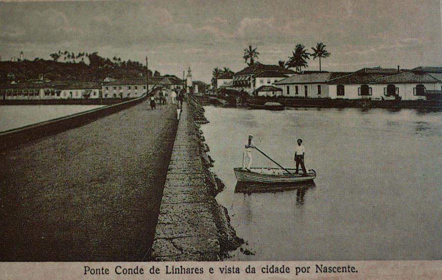
Ponte de Liñhares c.1900 - entrance into Panjim
5D Mark II, Zeiss 50 f/2 MP
Here the Remedios chapel in Ribandar is clearly seen. Take note of the unmolested hilltop and compare with image #3 above.
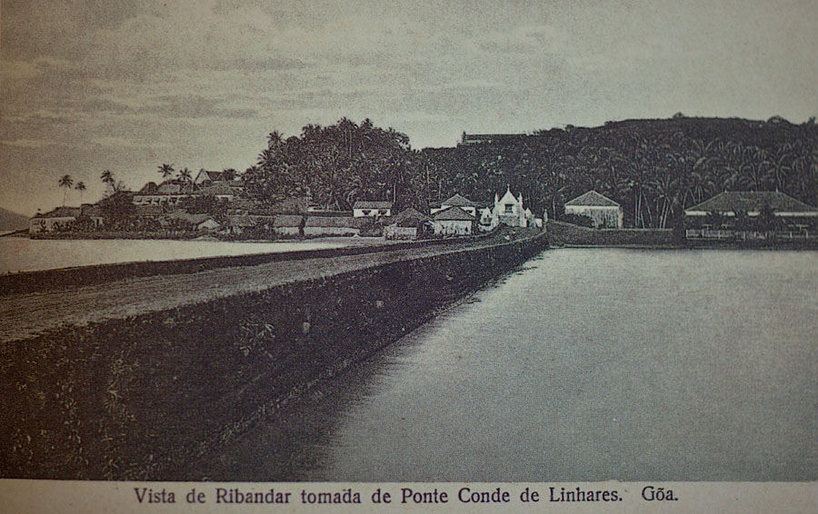
Ponte de Liñhares c.1900 - looking towards Ribandar
5D Mark II, Zeiss 50 f/2 MP
Go here for earlier installments of Panjim Promenade.


[…] Check out Ponte de Liñhares, built by the Portuguese in […]
thanks for the information regarding panaji and for olden photographs
For once I am happy that the heritage structures of Goa, from which ever period they may be, are being portrayed for their face value. These amazing shots have really given life to the history that is given along with. Great job Rajanbab!
too good. keeps memories alive of the old times.
edwin
RAJAN YOUR INSIGHTS AND PHOTOS ARE REALLY MARVELLOUS THANKS SO MUCH
Awesome pics makes one sentimental. Thanks for sharing invaluable info and historic facts.
This is really cool… with your permission I’m gonna use this on our blog in Goa. My mum did well to pass this on.
Cheers,
Ronsley
Just awesome!! Thanks for sharing.
just serene. don’t have to wonder why Goa was called the Rome of the orient. One just needs to take a glance at the images from a small portion of a small town in Goa from the past era.
nice work.
Dear Rajan
This is an excellant piece of work, so well executed and it si clear that you have done your research and well. when is the book coming out?
Clifford Pereira FRGS
Not only well photgraphed but well designed. Must do a book Rajan
Wendell Rodricks
Glorious sights Rajanbab. Thanks for taking us back in olden era and pondering as to what answers we can give to our next generation about DEVELOPMENT of Goa.
Thanks Rajan, that is brilliant.
Progress is a word that is meant to show something improved, better than the old etc etc!
But what do we see here? The real ugly face of progress, which makes my heart cry and reach out to dear old Pangim.
Goans must wake up out of their deep slumber and take off their blinds. Stop this plunder of Golden Goa, or there will be no Goa left for your grandchildren.
Rajesh
Nice Photos….
Old pictures are very good, how it has changed since then.
Keep Goa Clean and Green
As I read these words in today’s New York Times, this photo-essay also came to mind.
“As he watches these difficulties {regarding control of CO2 emissions}, Ralph Keeling contemplates the unbending math of carbon dioxide emissions first documented by his father more than a half-century ago and wonders about the future effects of that increase.
“When I go see things with my children, I let them know they might not be around when they’re older,” he said. “ ‘Go enjoy these beautiful forests before they disappear. Go enjoy the glaciers in these parks because they won’t be around.’ It’s basically taking note of what we have, and appreciating it, and saying goodbye to it.”
Rajanbab,
Sundor dekhave. Mon bhugaytta
Awesome.
I’ve traveled on this road many times – but never realized its historical importance, or the scope of the work involved in making this happen.
Lovely pics Rajan. Thanks again.
Nice photographs. Nice green color in one of the shots.
Good to see the archival photos to understand how things have changed. It’s really a pity that some of the places are turning out like this. Saw the same thing at Shimla. The whole mountain is gone. Only buildings and buildings!!
Just awesome photos. Olden photos shows how Panjim was once upon a time. Thanks for sharing.